


You have them on board, but admit it, you’ve never actually looked in them. Or if you did have a peep, you realised they were all in Dutch, might as well be double Dutch, and shunted them to the back of the book locker. But help is at hand guys…
With a bit of practice you can get a lot of information from your ANWB Wateralmanak and you only need to know a few words and where to look.
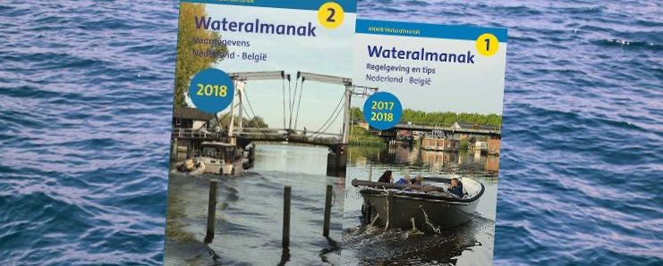
Firstly, the two parts. Part one, they tell you, is obligatory to carry on board. That’s not strictly true. You are required to carry a copy of the Dutch waterway regulations. You can download them here. For free. That’s that one done.
Now, the useful info is in the Part two book. This is updated every year by the ANWB who send out a questionnaire to every harbour master in the Netherlands. There’s more than 1000 of them in the book so they get a pretty good idea of what’s changed. They probably check stuff themselves too, but you get the picture, it’s up to date.
So, how do you make sense of all that information? First of all I recommend having two or three bookmarks to hand because you are going to have to look in several different areas. Restaurant flyers and business cards are ideal for this purpose.
Let’s take an example. You’ve arrived at Seaport marina in IJmuiden after a lovely flat crossing from the East Coast. You want to go Haarlem. You look on the chart and see you need to go along the Noordzeekanaal a little way, then turn off on a waterway called the Spaarne. Now, some navigational information is listed under waterways and some under place name – where it’s a big place. This one is under the place name
Get your almanak and look up IJmuiden in the first half of the book. This is a tricky one because you have to remember that IJ is treated as one letter which is the same as a Y. There are letters along the edges of the page to help you (if you’re stuck its page 476 in the 2019 edition). Put your first bookmark here. Look down the bold headings until you see Bruggen en/of Sluizen (Bridges and/or Locks). Then skip down to the blue highlighted box and you will see the service times.
1 apr-1 okt ma t/m zo en fd 0-24h
(1 April – 1 Oct Mon-Sun and bank holidays Operates 24 hours)
Just above it says you are to use the Kleine Sluis and this will be confirmed when you get to the lock and look for the blue sign that says Sport.
Now look up Noordzeekanaal. It will be before Nijkerk and Nijmegen because remember the ij is treated as a y (its page 310 if you are struggling but try to find it without – I won’t always be here!). Scan the bold headings for Maximumsnelheid (Speed limit). It says 18km/h, so about 9 knots.
When you try to look up Spaarne you will find only Spaarndam and the details are listed here for your next leg, so again it’s under the place name rather than the waterway.
Important sections to look at are the Maximumsnelheid – 6km/h; Marifoon (VHF) – the Sluis (lock) and the brug (bridge) are on kan 18 (channel 18); and the Bruggen en/of Sluizen. Look at the blue boxes, check the dates and days you are travelling, then look at the times. Op verzoek (on request) means you probably have to phone. Dagelijks (daily) and gesloten (closed) are other handy words to know.
If it says vaste brug (fixed bridge) you will need to look for the height which follows, given in metres, and check it against your air draught. Beweegbare brug means opening, and there will be some times and details of service to follow.
Assuming you navigate your way successfully through the locks you will want to start thinking about where to moor. This is where you turn to the facilities section. This is the second alphabetical index. Again there are letters down the edge of the page to help you. Haarlem starts on page 567. Each blue box is a waterway business, marina or harbour. The first one is Havendienst Haarlem and it says gemeentelijke passantensteigers. This means municipal harbour, visitors moorings managed by the town. A good choice for a short stay, likely to be close to the town centre and good value, and used to dealing with visitors! Put your next bookmark here as you will want to refer back to this page. The little icons list the services you can expect from each harbour/business. They are fairly obvious but there is an index at the front of the almanac with an explanation of each symbol and it is IN ENGLISH, yay! (page 27). Learn these!
Important ones are the picture of a boat with a number next to it, this tells you number of places available, and next to this a moon with the price in euros per metre for overnight stays. If it says tariff op aanvraag then you’ll have to ask. Showers, electric, water, fuel, pumpout – whatever you need, it will tell you here if they have it.
So, the first section is navigational details by waterway or place name. Second section is harbour facilities by place name. Keep both pages handy and try to learn the key words that you will see frequently. Really hope that this has helped and you can ask me any questions via the contact page.
